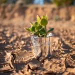
The sea, a common good, is the keystone of our planet’s climate system. The global economic system and our very survival depend on the preservation of our oceans and seas.
It was against this backdrop that the 5th edition of the forum de la mer which took place on Friday September 26th in Bizerte, Tunisia. An international meeting devoted to maritime issues. An opportunity to take stock of risks, challenges and possible solutions. .
Oceans and seas: the dangers facing humanity
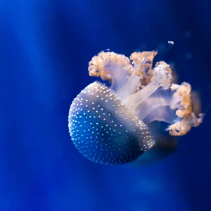
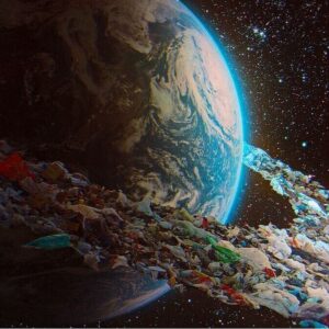
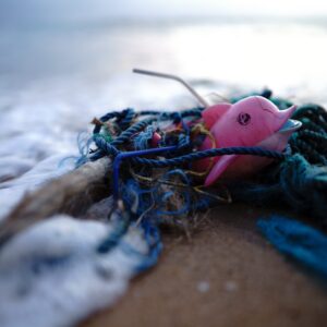
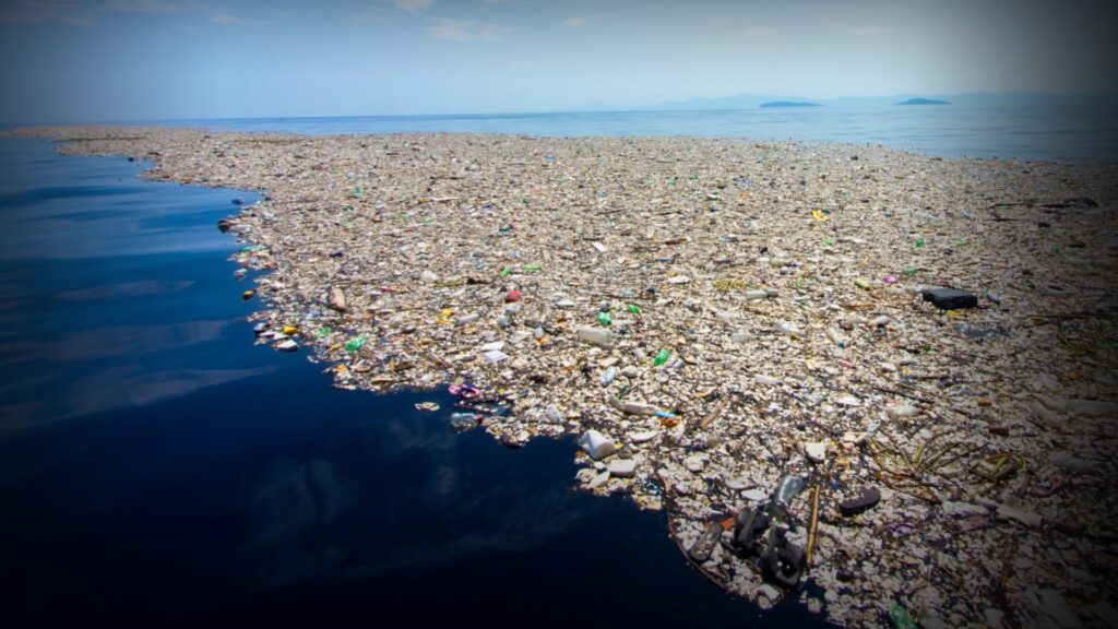
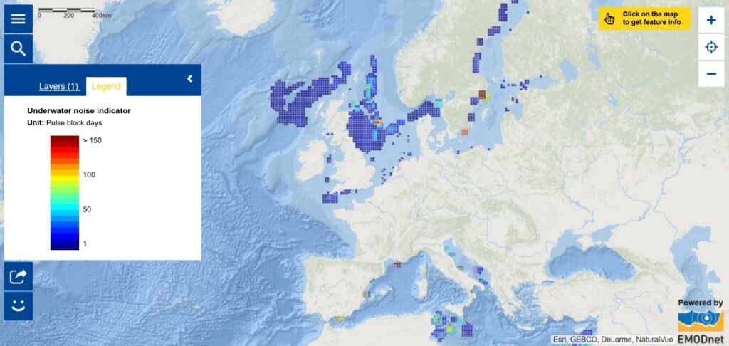
Oceans cover more than 70% of the earth’s surface. The Mediterranean Sea, the largest of the intercontinental seas, extends over 2.9 million km2 and represents 0.8% of the world’s waters. Situated between Europe, North Africa and Western Asia, it is, as its name suggests, “in the middle of the land”. Its position is a factor that exacerbates the concentration of plastic pollution. According to a 2019 report by the World Wildlife Fund (WWF), the concentration of plastic would make it the most polluted sea in the world.
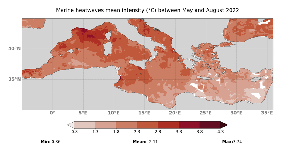
But pollution is not the only danger threatening the Mediterranean. This summer, the average temperature of the Mediterranean rose by 6 degrees above normal, a direct result of the climate crisis that is making the situation increasingly critical for living organisms:
“There are places in the Mediterranean where all summer long, for over 90 days, the temperature remained at the highest level we’ve ever experienced. The temperature reached maximums that never went down. Marine species are suffering enormously, there’s no respite, it’s constant and heat waves are dominant and invasive all over the Mediterranean, especially in the western part, and it’s catastrophic.”
Pierre Bahurel, Managing Director of Mercator Ocean.
La santé des océans et des mers : un défi géopolitique
For over 42,000 years, people have relied on the resources of the sea for their food.
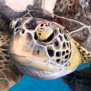
More than 3 billion people depend on seafood, which provides 20% of the protein in their diet. Given the economic impact of pollution and the climate crisis on the fishing, shipping and tourism sectors, the phenomenon can also represent a food security issue, because of the risks to the livelihoods of certain populations.
“In the Gulf of Guinea, 80% of food protein comes from fishing, and this area is currently being plundered in a very worrying way. Climate disruption is an essential element in this geopolitical equation, because climate disruption will lead to migratory crises and damage to biodiversity, so there will be less food in the seas.”
Yann Briand, Head of the Strategy and Policy Office of the French Navy Staff
With this in mind, the French Navy is working to protect the sea from any illegal activity threatening biodiversity, and to ensure environmental security in a context dominated by geopolitical issues:
“Since the fall of the Berlin Wall, we’ve had 30 years of crises in Africa, the Middle East and Asia, and each time we’ve returned to a more or less acceptable state of equilibrium. Now we’re faced with successive shocks that will accumulate: a health shock, an economic shock, a military shock with Ukraine, an environmental shock, and the world that emerges from all this in the end will be radically different!
Olivier Poivre d’Arvor, Ambassador for the Poles and Maritime Issues at France’s Ministry of Europe and Foreign Affairs, agrees.
“It’s on the sea that the major conflicts will be moving in the years to come.”
Olivier Poivre d’Arvor
Maritime areas represent a considerable geopolitical challenge, and are revealing new strategic ambitions for economic and demographic reasons. Figures show that 65% of the world’s population lives in port and coastal areas.
“Today, the sea is an economic object with vast resources. By 2030, revenues from the sea will be greater than those from the land, so this obviously whets the appetites of countries, states and companies. Any form of appropriation and privatization of the sea can threaten it. We believe, in view of climate and environmental issues, that the sea is a common good that must be protected. It cannot be privatized!”
O.P.d’Arvor
Humanity is reaching the limits of what can be exploited on Earth, and faced with the needs of populations and the associated political stakes, governments and companies are turning their attention to what remains exploitable on the planet: the sea. The result is a race for marine resources, from shoals of fish to critical metals and the exploitation of oil and gas. Some countries are committed to regulating maritime space more than is already the case, so that exploitation can continue within a legal and regulated framework.
These economic exploitations revive historic disputes and are sometimes used to justify the desire to control maritime zones. It is becoming urgent for states to work together on shared governance of the oceans and seas.
“There are many mechanisms in place for the Mediterranean, such as the Barcelona Convention, but none of them can produce the shock of cooperation that makes the 21 countries work together. The shock of cooperation is also to avoid this shock of polarization between economic interests, the defense of the environment and the interests of certain nations that want to possess natural resources.”
O.P d’Arvor
It is clearly urgent for countries to work together and share science, diagnoses and solutions, yet the reality seems quite different according to Y. Briand:
“At a time when we need to be around the table discussing how to protect the environment, we’re not doing so at all between the major powers, and that’s extremely worrying. In addition to the migratory crises, there’s also the pollution caused by climate change and marine pollution – it’s quite a worrying cocktail,” says Y.Briand.
L’espace et l’intelligence artificielle au service de la connaissance des océans et des mers
Despite all these threats, the lack of multilateral cooperation and environmental and geopolitical challenges, scientists, climatologists and sailors sometimes work together to find more efficient and effective ways to better anticipate anomalies in the sea and protect biodiversity. It is precisely this anticipation work that enables us to deal more effectively with crises. Mapping the ocean floor is a perfect example of this salutary cooperation.
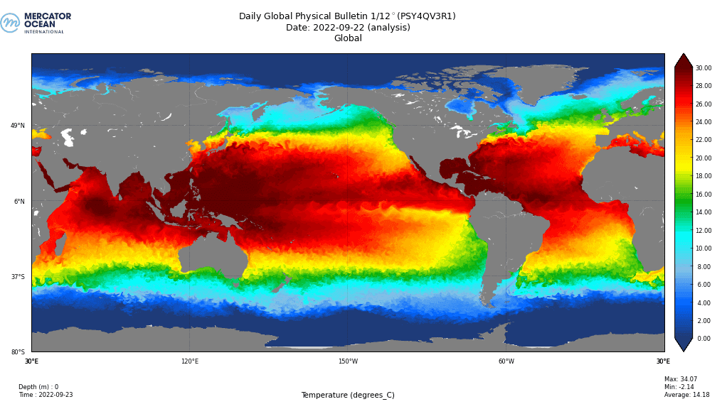
To understand planet Earth, it is important to map its ocean floor. To this end, scientists use ocean observation satellites to better understand our planet’s climate evolution and safeguard marine ecosystems.
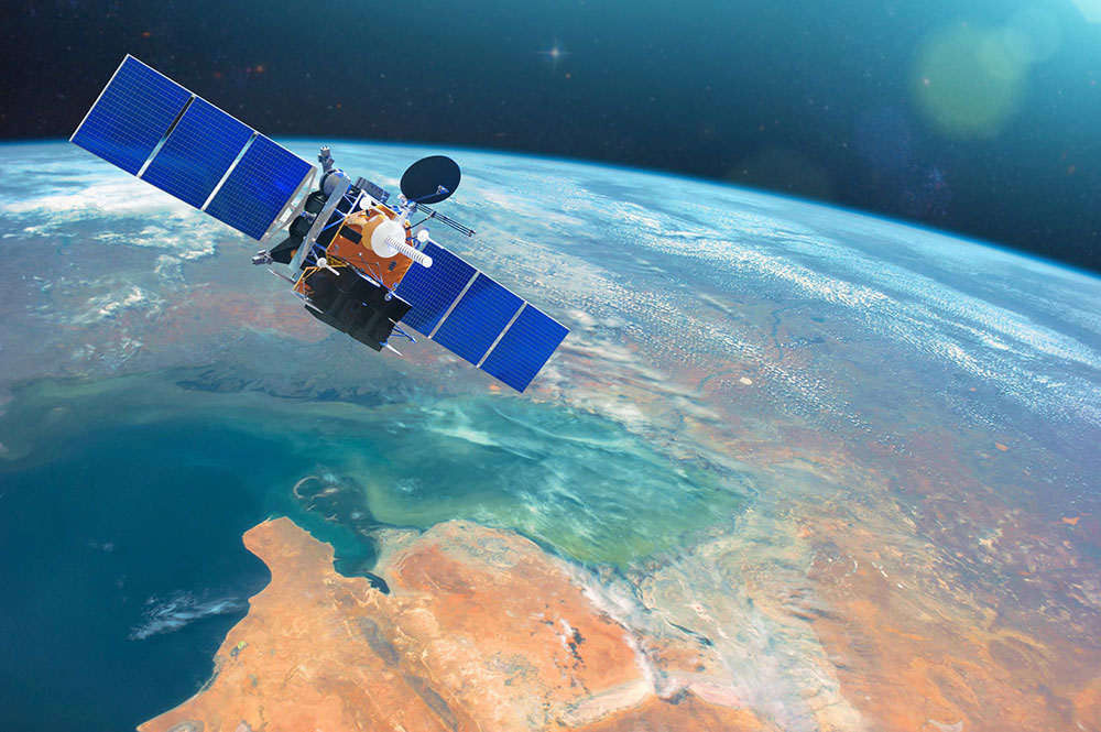
These satellites provide camera images, radar images and raw data for analysis by scientists. P.Bahurel asserts that:
“These satellites allow us to obtain more precise mapping of the oceans, and on top of that to make a map that covers the whole planet earth in 10 days. This has unleashed a whole new discipline of operational oceanography, which consists of forecasting and bulletins like the weather, but for the ocean.”
P.Bahurel
These satellites also provide precise real-time measurements to monitor temperatures, currents and phytoplankton concentrations. These measurements are essential for the conservation of marine biodiversity, as they help to anticipate crises such as food shortages and migration. Y.Briand, explains the importance of these measurements and of cooperation between marine scientists:
“We’re working with Sorbonne University and the Tara Ocean Foundation It’s very interesting because plankton is present where there are fish, where there are fish people can feed, if the plankton is no longer there, there will be no fish, so there will be crises. We need this scientific link to anticipate crises.”
Y.Briand
But the role of this technology is not limited to taking a snapshot of reality at a given moment. Satellites also enable us to anticipate the future. The maps produced by satellites are transmitted to climatologists and biologists, who analyze them and draw up possible scenarios for climate change and risks to marine biodiversity. One of the added benefits of satellites is their ability to observe the impact of man on marine ecosystems and predict possible anomalies. In 2019, for example, satellites were used to monitor the oil slick caused by the sinking of the Grande America cargo ship.
“We’re very keen to work with private companies using satellite observations to make the best use of our boats. We have 11 million km2 to monitor, so it’s important to send our boats to the right place at the right time, and it’s thanks to satellites that we’re able to do this,” says Y. Briand.
However, “life is not easy to model.”
P. Bahurel
In the face of such complexity, Artificial Intelligence (AI) offers a glimmer of hope. By offering new solutions for collecting, structuring and exploiting data, AI can provide unprecedented resources for taking a current snapshot of the state of biodiversity and predicting its evolution. Applied to the marine environment, these innovations can help ensure the conservation and sustainable use of marine and coastal ecosystems, thanks to Big Data.
“The challenge today is to create a digital twin of the ocean in which life exists, and to be able to have a model that allows us to question the scenarios we are living through and the impact of our decisions.”
P. Bahurel
This article was developed in collaboration with the Earth Journalism Media Mediterranean Initiative project.
Copyright © 2022 Blue Tunisia. All rights reserved